
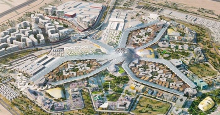
Everyone is excited about the upcoming Expo 2020 Dubai. If you are wondering what the site looks like now, you can view it without having to go there! All you have to do is check out its Google Map satellite images.
Based on the official Twitter account of Expo 2020 Dubai, everyone can explore the site using Google Maps. With just one click, you can see the progress of one of the city’s biggest projects, which will be held on a 438-hectare area in the Dubai South.
With new #Google Maps satellite images, you can see what’s happening at the #Expo2020 site. See for yourself at https://t.co/cTVL5P6r9B pic.twitter.com/w2KRWIupD5
— Expo2020Dubai (@expo2020dubai) March 1, 2017
From October 2020 to April 2021, more than 25 million visitors are expected to join Expo 2020 Dubai. Formal construction on the site began in September 2016, and has been divided into three sections.
The first section focuses on building the Expo Village, where visitors will reside during the event. This includes setting up water systems, electricity, sewage, and telecommunications. Meanwhile, the second section involves “deep infrastructure” construction within the site’s gated area, and the third section covers the road networks.
#Expo2020 #Dubai, seen from above on Google Maps. You can already make out key features of our site. Explore more at https://t.co/cTVL5P6r9B pic.twitter.com/wd1qcVADIM
— Expo2020Dubai (@expo2020dubai) March 2, 2017
All infrastructure work at the site is expected to be complete by October 2019, which is one year ahead of the event. This would give enough time for organizers, participants, and visitors to prepare for one of Dubai’s most exciting events.


Comments are closed.